Hiking the Rancheria Grande

by Carolyn Henderson

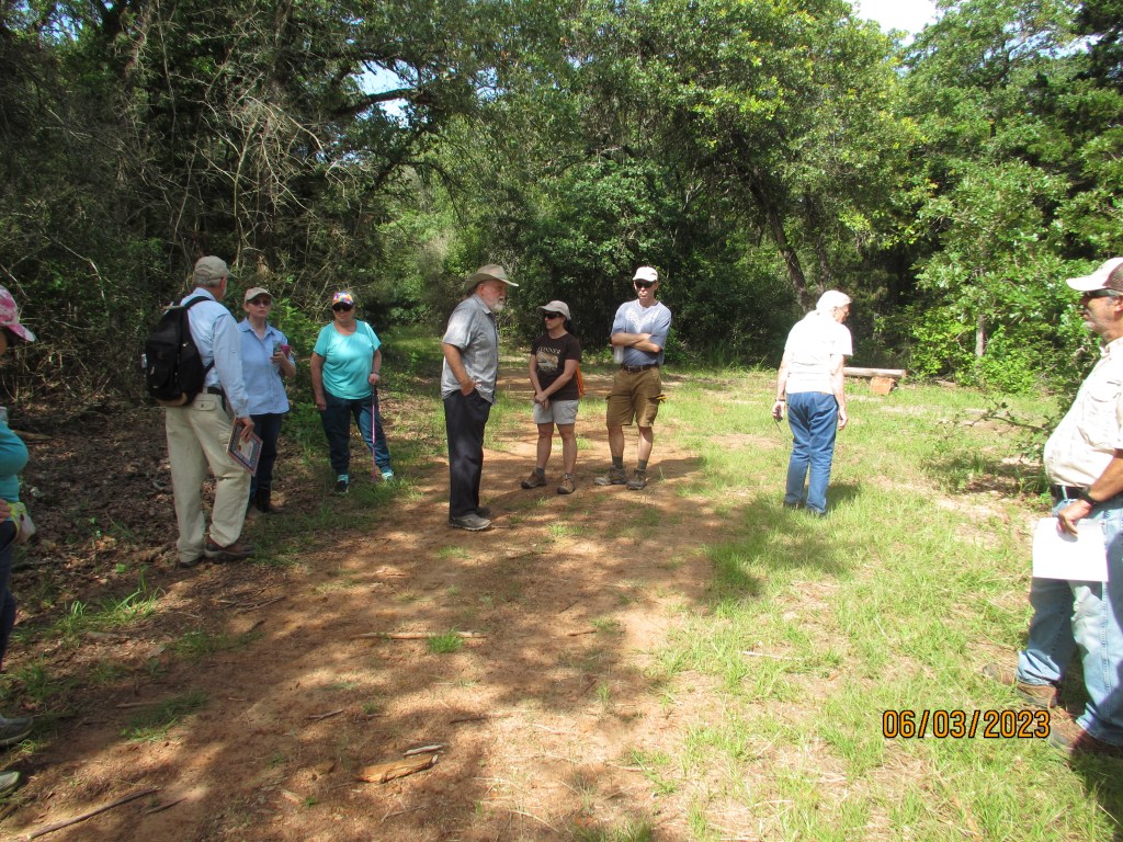
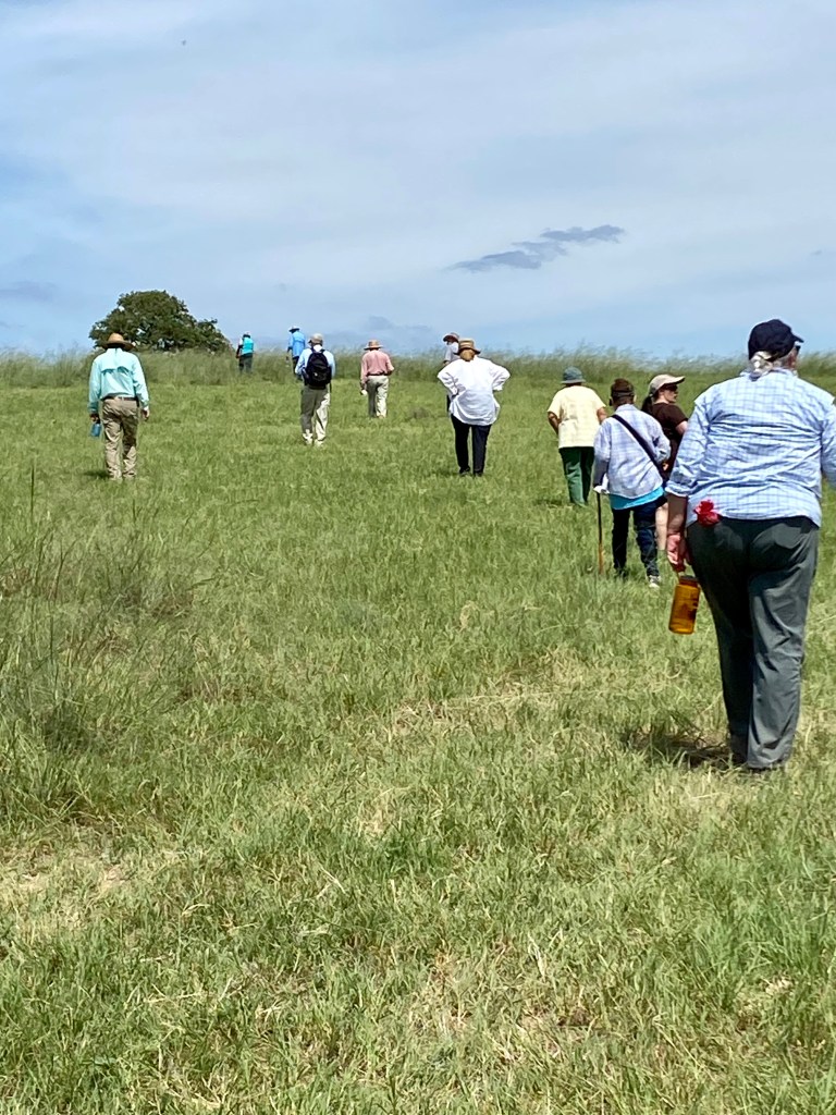
To walk where Spanish settlers walked hundreds of years ago and native tribes lived their lives, even thousands of years ago is an inspiring experience. Members of the El Camino Real chapter Texas Master Naturalist and El Camino Real de los Tejas National Trail Association got to experience it firsthand Saturday in a guided tour of a trail in development.

The group after their hike

The trail is part of the El Camino Real Trail that spans a good part of Texas. The part travelled Saturday, June 2, runs across the Cedar Hill Preserve, owned by Mike and Joyce Conner, and the Baumann Ranch. The Conner property is being developed as a native flora and fauna preserve, and the adjoining Baumann ranch is still a working cattle ranch. It is now part of the National Trail Association, and it is being prepared for study and hiking for organized groups in the future.

The trail head

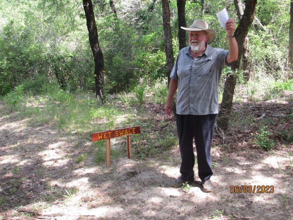
The wet swales were probably formed by water traveling in a path through the area in wet seasons then later used by travelers.

Mike Conner talks about the wet swale

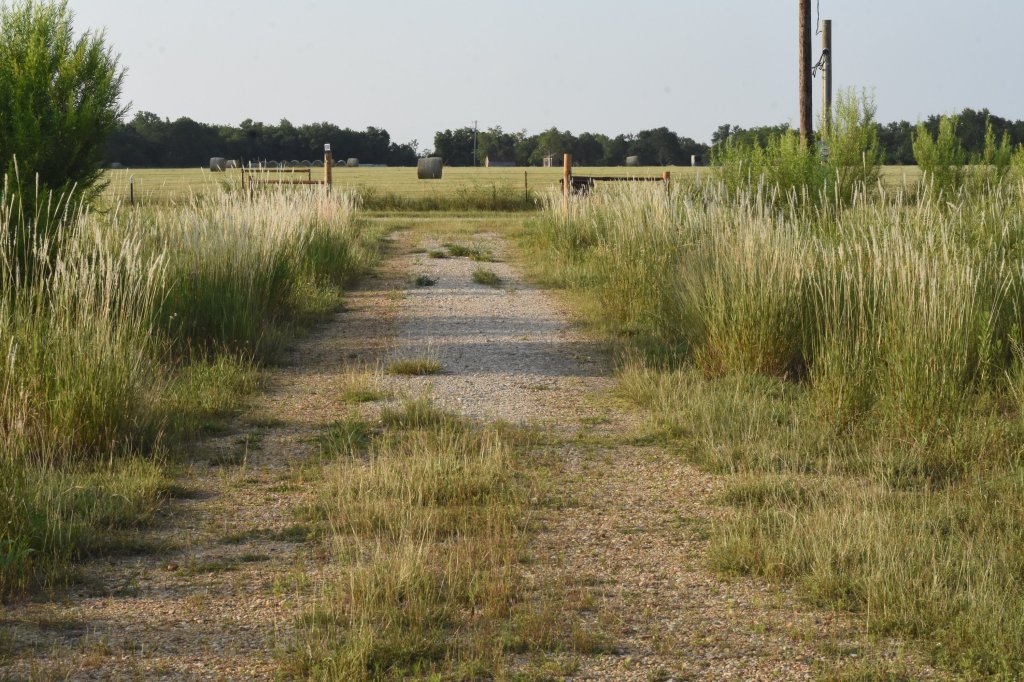
The trail head begins in a woody area on sandy loam soil complete with a fancy new outhouse somewhat like your grandparents had in this area. In many areas a hiker can actually see the trodden
path taken by Spaniards and Native Americans dating back hundreds and probably thousands of years ago. They are most discernable by swales that bank the path. A swale is a buildup of land running along each side of the ancient trail. It looks a bit like a street curb might look today. There are both dry swales and wet swales. The dry swales were strictly roads/paths taken by travelers.

Dry Swale (photo by Michelle Lopez)

There also are signal trees believed to have been formed by the native tribes to give direction
then later used by the Spaniards. Artifacts from both groups have been identified by archaeologists
studying the area. Post Oak trees primarily were used to form these trees.

Signal Tree

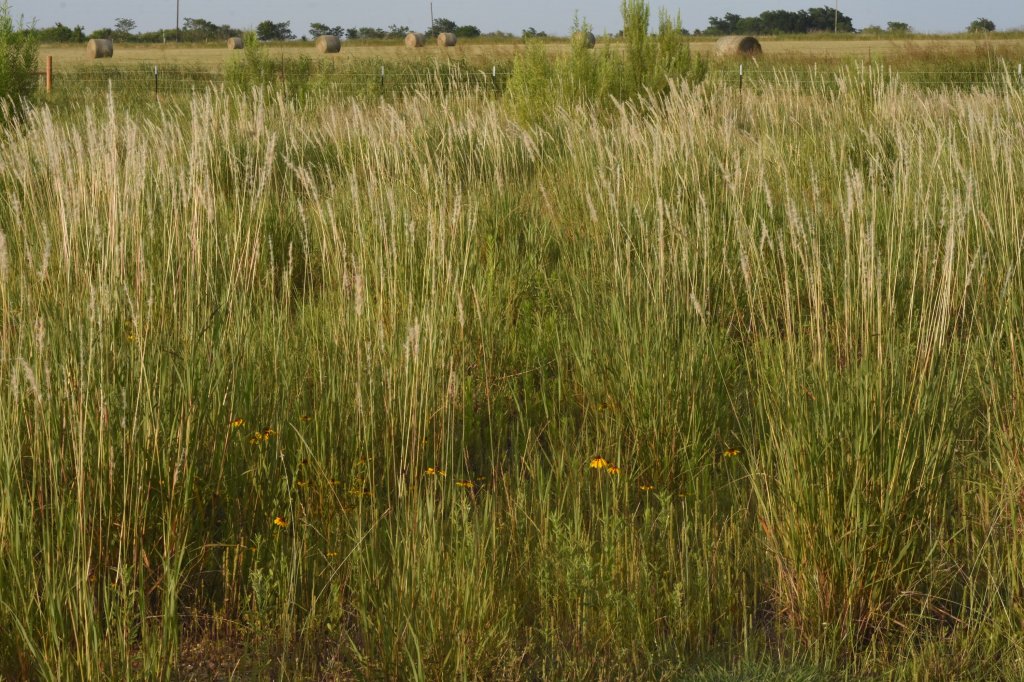
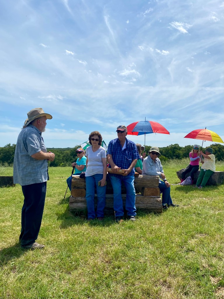
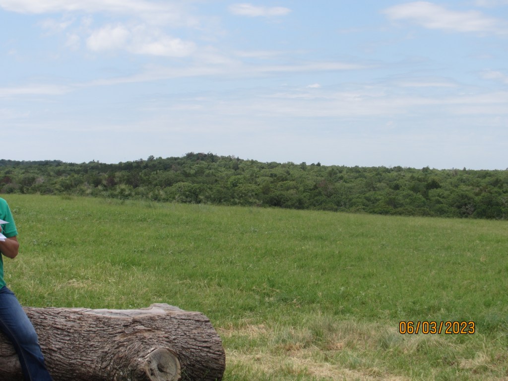
When you come out of the wooded area, you are then on an uphill stretch to reach the very high hilltop. The top of the hill is like a meadow looking out at the woods below and nearby hills or “mountains.” Sugar Loaf Mountain is very near and visible from this hilltop. It is believed that this hilltop where we were was a village for a native tribe or tribes over the years. Tonkawa artifacts have been identified from the area. There was a great deal of speculation by the hikers that the different tribes sent smoke signals to each other from these hill tops. A visit to Sugar Loaf Mountain has long been a rite of passage for area high schoolers.

This area is part of the Rancheria Grande Los Brazos de Dios. An archaeological dig in the area around Alligator Creek and Pin Oak Creeks, both of which cross these properties, a few years ago found evidence of very early Spanish settlements.

Trail loop

Mike Conner and Dr. John Pruett, tour guides for the adventure, and Mr. and Mrs. Baumann, explained the history and discoveries while the rest of us recovered from the climb. Joyce Conner etched a map of the trail into a homemade tabletop. It sits at the top of the hill.

Joyce Conner’s tabletop map

Going downhill was easier, but one could certainly feel the rising midday temperature. An appreciation of what people had to go through to get anywhere hundreds and thousands of years ago is brought home when hiking this trail.

The Baughmans (center)

There is a book titled The Archaeology of Rancheria Grande Los Brazos de Dios, written by Sergio A. Iruegas, archeologist, and Melinda T. Iruegas, about the discoveries in the area. It is currently out of print, but there are copies at the Cameron and Rockdale libraries. If you own land in that area, you may be sitting on artifacts.

Mike Conner talks about the trail

Addendum

by Mike Conner

I would like to clear up a little confusion about swales.

Swales are u-shaped, linear depressions in the ground formed by many years of foot and hoof steps. They are never formed by water but may be damaged by water once they are formed. This is happening to some extent to Hidden Swale. Both the Dry and Wet Swales have been certified by archeologists to have been used during Spanish colonial times but may have been used for thousands of years before. The somewhat confusing names for these two swales come from the fact that the Dry Swale leads directly to the historic village site and cuts through a small valley that would only be passable is fairly dry weather. The Wet Swale leads in a less direct route to the historic village site that goes around the edge of the valley and would be passable in wet weather.

Johnson Grass War Update

by Eric Neubauer

Finally, I’m seeing significant results in my attempt to convert about three acres to a modern bunchgrass prairie. It’s been five years since the last crop, wheat, grew here. After a couple of years, it became obvious that Johnson Grass was my greatest enemy because it could out compete all the
other plants leaving dense, impenetrable groves of nothing else. Herbicides weren’t an option because there were many native species coming up that I wanted to preserve. So, my only option was pulling up the Johnson Grass by hand. There were also several other non-native grasses, but nothing that would take over.

The first image is looking down the driveway. Instead of being lined with Johnson Grass, it’s lined with 5′ tall Long-spike Beardgrass.

The second image is looking to the side. Although the Beardgrass appears impenetrable, it’s possible to walk between the bunches. In the meantime, the wildflower seed bank has been gradually returning and filling in the gaps. Pinkladies and Frogfruit were some of the earliest species to arrive, but others have followed.

The third image is a place where wildflowers have taken over. That area was entirely Johnson Grass
three years ago, and now only requires occasional attention to remove any new Johnson Grass seedlings. Not shown is the Poverty weed and Mesquite that has sprung up to give the landscape texture. It’s apparent I’ll need to thin out the Mesquite eventually.

Water Needs for Plants and Our Wild Friends

by Donna Lewis

Right now it’s 7:00 am and go outside to put up the bird feeders and fill up all the bird baths.

The birds are eagerly awaiting my food offerings. The mosquitoes are waiting just for me! I have to wear long sleeves that I hate.

This is delicious!

Anyway, we need to remember our birds, bunnies and other critters need water that is accessible.  Putting it under some shade helps keep yhrm a little cooler. Of course, that also gives the cats a place to hide and pounce. So, use common sense about water placement.

Bird baths should be varied in height. That gives everyone a chance to drink. Make sure to put a stone in the bottom so the babies don’t drown.

I fill all (10) of them every day.  And people wonder why I have so many birds.

So many feeders!

In the evening as a treat, I will put out a sprinkler in one area and leave it on for about 30 minutes.   The birds go crazy and call all their friends.  It’s great to watch them.

The morning is also a good time to water the plants in your garden.

Remember if you use sprinklers, you wash off the nectar on a plant which takes hours to replace. So, watering under the leaves and flowers is the best.  I know it is not always possible to do that.   In that case rotate the watering, so there is always nectar on some of the plants.

Helpful rocks!

Don’t forget to place your hummingbird feeders under a shaded area and change it out every three days when it is hot. It’s always hot here in Texas.

I hope these tips help.

Remember who you are gardening for.

Lemon Mint or Purple Horsemint

by Donna Lewis

Many of us who own some acreage probably are seeing this unusual plant right about now It goes by several names: Beebalm, Plains Horsemint, Lemon Beebalm, or Purple Horsemint, while its Latin name is Monarda citriodora.  Wow…who knows what to call it?  I don’t think the botanists can agree.  Myself, I like easy things to remember.

I also have noticed that after looking in four different reference books from my own library, it can look very different from the photo in each book.  That is confusing for sure. I think the soil has something to do with the shade of pale yellow and the purple color.

This one at Donna’s house is quite purple.

This plant likes dry, sandy, or rocky soils. It grows one to three feet tall with leaves up to two to three inches long and is a member of the mint family. It is an important pollinator plant here in Texas.

This one is from the Walker’s Creek area near Cameron and is more pink. Photo by Sue Ann Kendall.

So don’t mow it down, it’s NOT a weed.

Have you done something for the planet today?

What a Treat for the Wildscape

by Catherine Johnson

Every inch of the Wildscape was explored recently at a Mason Bee program for Milam Home School Co-op. Forty-one people attended, which included twenty-six children and seven Master Naturalists. After the bee houses were assembled, everyone took off to all parts of the garden observing butterflies, hummingbirds, and spiders.  The children enjoyed refreshments, hide and seek, and receiving goody bags and nature books.

The parents were interested in building their own Wildscapes and want to return for free native plants. We enjoyed ages from baby to teens and hope to spend more time with them at the Wildscape.