The Yegua River

by Alan E Rudd

Labor Day weekend this year cried out for a river trip, and the only “river” that was running hard on September 3 was a portion of the stream that the Spanish explorers dubbed the Rio San Francisco.  Stephen F. Austin drew a map of the expanding land grants between the Brazos and Colorado Rivers in 1829 and labeled this same stream Yegua. It stands to reason that those people occupying the land at that time had identified this watercourse as a place populated with horses. Yegua in Spanish are female horses. A valley to the west of the Brazos River with a significant abundance of horses deserves such a distinctive name. St. Francis of Assisi was already known as “the patron saint of animals” when the Spanish priests were spreading their culture north into Texas circa 1690. His name would be attached to many other places and a few streams. The Texas stream that is named after the horse populations attracted to its bottomland habitat is a special kind of place.  It was my time to explore it.

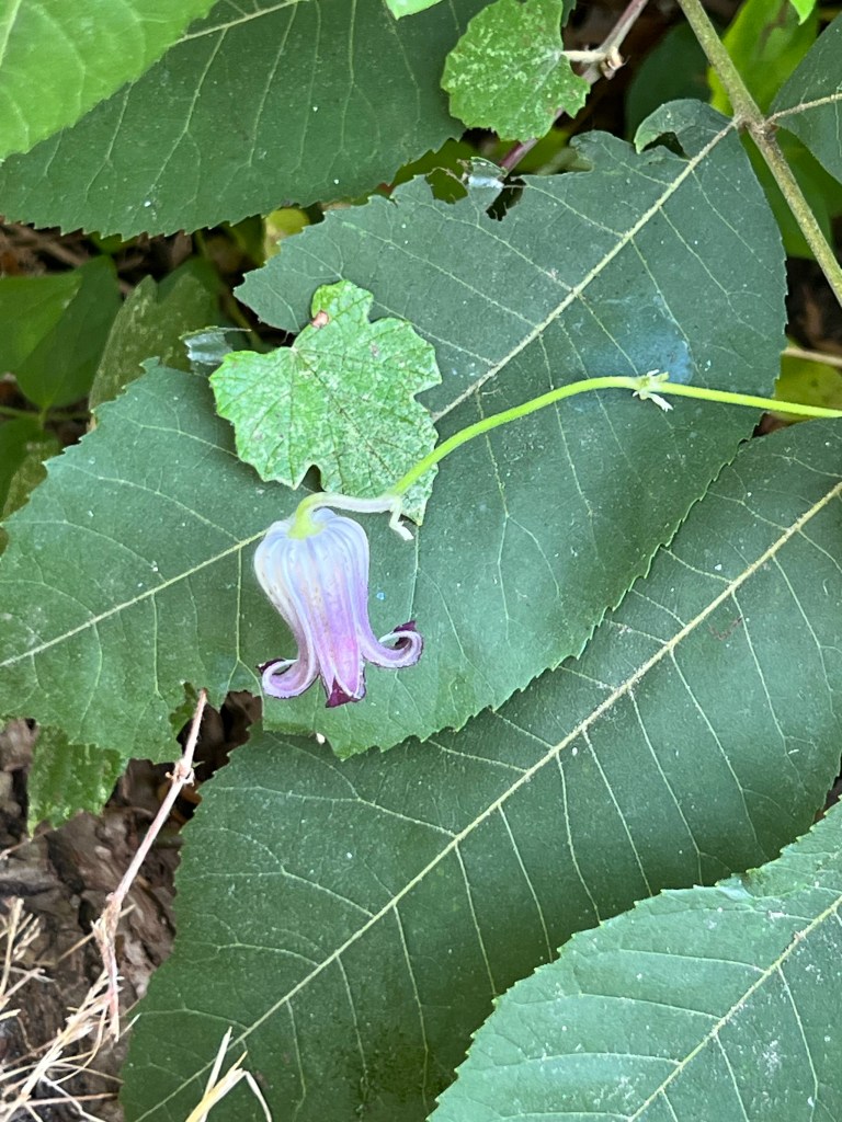
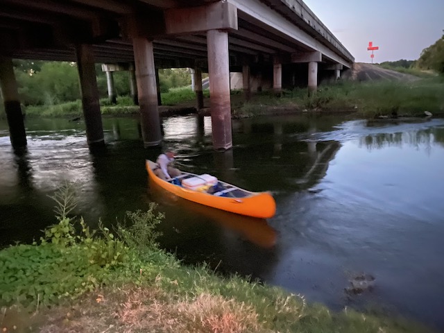
Adam and I put boats into the water of Yegua Creek below the Hwy 36 bridge in Somerville. It was before dawn, and I was hoping to paddle the first portion of a 13-mile run in moonlight.  As luck would have it, we were running a bit too late, and the moon was slightly obscured by thin clouds anyway.   Angie was our driver and her photographs taken as we shoved off show an orange dawn sky looking downstream.  Turns out it was a darn good thing we could see well because the first three miles of this trip seemed like a combination of paddling through a Venezuelan jungle and the log-ride at Six Flags. We needed full visual acuity. Short-statured elm trees reached far out from each shore, and you had to weave around them.  Open shorelines were densely populated with sedges, rattle bean, millet, and smartweed. Somerville Dam was just a mile upstream and was releasing 366 cubic feet per second to supply users down near the Texas coast.  In this 40-60-foot-wide channel the water was pushing hard toward the Brazos and shoving our boats with it. 

The narrow channel was alive with insect life on the water surface and in the air above it. There were clouds of small insects buzzing about us but not biting or landing upon us. I suspect they were midges (I inadvertently swallowed several but could not identify species from the taste), and they were being attacked and fed upon by an astounding number of dragonflies. In the dawn’s early light thousands of dragonflies of many sizes and colors were passing through the dense haze of Chironomids and eating them in mid-air. Looking upward was like watching tuna feeding on schools of sardines. Dragonflies were to be over and around us all day.

Lots of supplies in Alan’s canoe

One of my worries about running a narrow creek was about how many large trees would be lying completely across the channel.  Very rapidly Adam scraped over the top half of a semi-submerged log in his kayak but my cargo canoe loaded with water and food could not pass. We pulled to shore, carried the cargo around and then portaged the canoe 60 feet to reload and relaunch. This turned out to be the only portage of the day and I pointed out to Adam that many famous “canoe trails” in Maine and Minnesota have ¼ mile portages between upland ponds that have no water flowing between them.  This kind of portage was a cinch unless there turned out to be one tree every half-mile. 

Very rapidly we were off, and then came the rapids. The first was a washed-out concrete vehicle crossing that had collapsed in the middle. Both boats sailed through the gap and the Yegua carried us soon to a second loud crashing of water half a mile downstream. This spot was a concentration of large rock rip-rap strewn across the channel and below a powerline that supplies Somerville and Caldwell.   Construction crews likely used this material when stringing wires 50 years ago. The heavy water flow got us over the rocks and into the big eddy four feet below. No problem! However, this day was far from over.

The next rapids could be heard but were hidden around a hard right turn. It ended up being a steep drop of 5-6 feet. This spot is a natural rock formation.  The 366 cfs filled my boat when I went over the drop and was pushed sideways into a rock wall. This, dear hearts, is why we tie all our gear securely into the canoe.  

The entire boat was full of creek water in under three seconds and was being pushed rudely downstream. The water jugs, canteens, Pelican box holding my I-phone, ice chest (strapped tightly closed), first aid kit were all attached. Adam, who had shot through the rapids ahead one minute ahead of me in the kayak, had spun around to watch as I inelegantly exited my boat and was floating along beside it in my ugly brown PFD (personal floatation device). Don’t ever let anybody tell you it is too hot to wear a PFD (even an ugly brown one), especially on a reach of river that you have never traveled before. We were shoved downstream 300 yards along straightaways and around corners before an adequate sandbar was located to pull up the water-filled canoe. 

The PFD was absolutely essential to keeping me from snagging a pant-leg or belt on a submerged tree-limb while being dragged along. The water temperature felt good in late summer, but in winter getting “tumped” over would have been a problem that required quickly building a fire to heat up a shivering paddler (me). Yet another reason you never paddle alone. It is hard to start a fire when you are shaking like a coon-dog trying to pass a peach pit.

Adam in kayak ready for adventure on Yegua Creek near Lake Somerville

The fourth rapid was halfway through the trip and had a large rock in the middle of the river.  A lunchtime spot! The rest of the trip was delightful. Magnificent pecan and willow trees over-hung the river. We paddled in the shade almost the entire day.  Without question the largest black willow trees I have ever seen stand like mythical giants along the Yegua. I wondered what it takes to be the state record Salix nigra? Two of these we saw had to be contenders.  

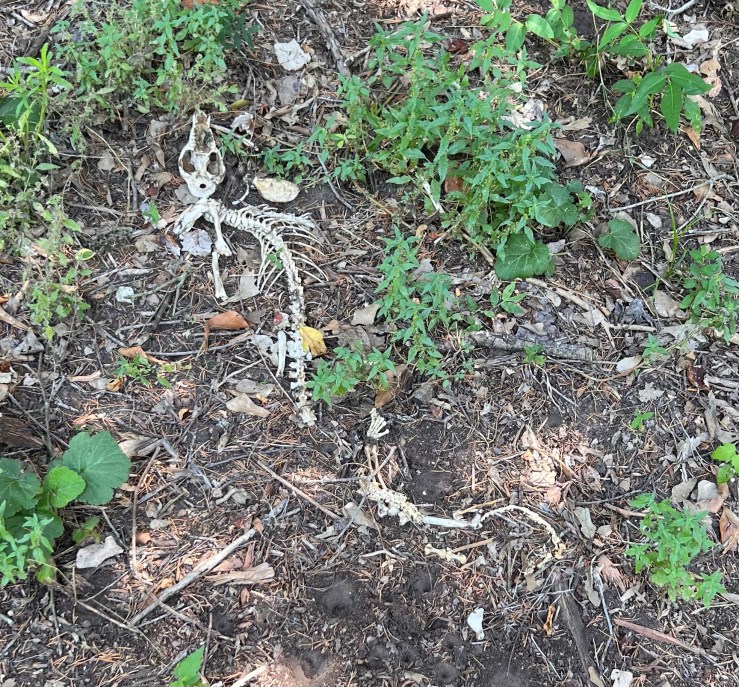
Beautiful live oaks grew on both the Washington County bank and the Burleson County shore. Big antlered deer and feral hogs were sleeping and feeding in the lush green growing on the shoreline sandbanks. There were two old, abandoned county road bridges. Cattle swam and waded back and forth across the county line (who needs bridges?).  We noted two minimalist fish camps but not a single drop line was seen. This apparently is rod and reel territory.

Adam and Alan on Yegua Creek near Lake Somerville just past HWY 36 bridge

Having unceremoniously plopped over my trusty OUACHITA, I was glad I did not bring my binoculars. Many small birds flying across in front of me consequently went unidentified. I did note eastern phoebes, pileated woodpeckers, a lone anhinga, wood ducks, a Louisiana heron, green herons galore, and great blue herons. At least my vision is still good enough to see the big ones!  

The surprised behavior of a lone coyote suggested he had never seen a boat before. Deer antlers seem big this year based upon the whitetail bucks we flushed. That cool rainy spring must have provided protein at the right time for a lot of grazing animals. Francis of Assisi would be pleased.

The nice thing about this canoe trail is that it has easy access to put in on Hwy 36 and easy access to take out at Hwy 50 near Clay, Texas. Driving home through Independence and eating Mexican food at Las Fuentes in Somerville after a 6-hour paddle was a sweet finish to a Labor Day Sunday trip. Always bring dry clothes or lunch must be eaten in the outdoor heat. 

Nowadays the Yegua is considered a “creek.”   After experiencing the intensity of the flow and taking a thorough dunking at a natural waterfall I can see why those well-educated Padres and Spanish Expedition commanders wrote down in their diaries that the San Francisco was a river.

Yegua Creek, which is actually a river. Photo by Alexey Sergeev, 2020. Public domain.
(as you read on you’ll see why Alan shared no personal photos)

Weird and Interesting Sights

by Sue Ann Kendall

This post isn’t about Milam County, but it’s about some nature I observed at Fort Parker State Park, near Mexia and Groesbeck, Texas, to the north of here on the Navasota River. Since we have readers from all over the area, I’m hoping for some feedback on some of my sights, and for some high-fives about a few cool observations.

The trails were surrounded with beautiful Turk’s cap plants in bloom.

Even though we are under a giant heat dome, it was pleasant at the shady park during the mornings, so I did my longest “hikes” then (as anyone who’s gone on a walk with me will know, I stop an awful lot on hikes). The biggest highlight of my trip happened when I was on the river trail. I was busily listening to birds (vireos and more vireos), when something moved to my left. It was extra-brown and looked like mobile leaf litter. The shape told me I’d stumbled across a Chuck-Will’s Widow (Antrostomus carolinensis), my favorite nightjar! By standing still/creeping around, I managed to get photos that were identifiable, which excited me greatly. You don’t often see these birds; you more often hear them. as they are very loud and nocturnal. I’d only seen one of these birds one other time. So, that was enough nature for me, right there.

As good as my photography gets.

Of course, I found many other things. A couple of flowering plants were new to me, including this one, which could be one of two plants, both of which have the common name of butterfly pea or pigeon wings: Clitoria mariana or Centrosema virginianum – I’d love some help getting the right identification for this flowering vine, which is one of the most beautiful things I’ve ever seen.

There aren’t many flowers, but the vine itself is really interesting, because it grows very long tendrils that hang down gracefully.

Another thing I saw that I could use some identification help with is this mammal skeleton. Could it be a fox or a coyote? It has large canine teeth. Or am I missing something obvious?

A former animal

There was other evidence of creatures that have moved on, too. All over the part of the park near the lake are holes that look recently dug, with white things scattered around them. There were dozens of them.

My thought is that these are recently hatched turtles. I did see a few mounds of dirt that resemble turtle nests I’ve seen before. If even some of these made it to the lake, that’s a LOT of new turtles out there! I have a feeling all the egrets around the lake are happy with this potential feast. Do these look like turtle eggs to you?

That does it for my mysteries. I thought I’d share a few other bits of interesting nature that I ran across. Let me know if any of my IDs are wrong, and be sure to go correct me over on iNaturalist (I am sunasak).

If, for some reason, you’re dying to see the many, many other plants and insects I saw over the weekend, feel free to visit my personal blog:

Or for you hard-core observation lovers, I’m sunasak on iNaturalist. Please go confirm or deny my identifications! I appreciate it so much, and it helps me learn more.

Early Isn’t Early Enough

by Catherine Johnson

Kim and I worked at the Wildscape early one morning, but it was not early enough. When we left at 9:30 it was oppressive. We aim to work from 7:00 until 8:30 next time. The humidity is what makes you feel ill.

Texas Kidneywood

Many native wildflowers are in bloom. There are native seeds and plants to give away. 

Mexican Hat and Elbow wood

At some point, one of our native plant experts is going to verify which of the Native plants in the Wildscape are native to Milam County.  We will try to get some endemic plants in the garden as well. 

Mexican Honeysuckle

Pictured are Texas Kidneywood, Mexican Hat and Elbow bush, Mexican Honeysuckle, Wild Bee Balm, Englemann Daisy, Milkweed, and Black Eyed Susan, among others.

Hiking the Rancheria Grande

by Carolyn Henderson

To walk where Spanish settlers walked hundreds of years ago and native tribes lived their lives, even thousands of years ago is an inspiring experience. Members of the El Camino Real chapter Texas Master Naturalist and El Camino Real de los Tejas National Trail Association got to experience it firsthand Saturday in a guided tour of a trail in development.

The group after their hike

The trail is part of the El Camino Real Trail that spans a good part of Texas. The part travelled Saturday, June 2, runs across the Cedar Hill Preserve, owned by Mike and Joyce Conner, and the Baumann Ranch. The Conner property is being developed as a native flora and fauna preserve, and the adjoining Baumann ranch is still a working cattle ranch. It is now part of the National Trail Association, and it is being prepared for study and hiking for organized groups in the future.

The trail head

The wet swales were probably formed by water traveling in a path through the area in wet seasons then later used by travelers.

Mike Conner talks about the wet swale

The trail head begins in a woody area on sandy loam soil complete with a fancy new outhouse somewhat like your grandparents had in this area. In many areas a hiker can actually see the trodden
path taken by Spaniards and Native Americans dating back hundreds and probably thousands of years ago. They are most discernable by swales that bank the path. A swale is a buildup of land running along each side of the ancient trail. It looks a bit like a street curb might look today. There are both dry swales and wet swales. The dry swales were strictly roads/paths taken by travelers.

Dry Swale (photo by Michelle Lopez)

There also are signal trees believed to have been formed by the native tribes to give direction
then later used by the Spaniards. Artifacts from both groups have been identified by archaeologists
studying the area. Post Oak trees primarily were used to form these trees.

Signal Tree

When you come out of the wooded area, you are then on an uphill stretch to reach the very high hilltop. The top of the hill is like a meadow looking out at the woods below and nearby hills or “mountains.” Sugar Loaf Mountain is very near and visible from this hilltop. It is believed that this hilltop where we were was a village for a native tribe or tribes over the years. Tonkawa artifacts have been identified from the area. There was a great deal of speculation by the hikers that the different tribes sent smoke signals to each other from these hill tops. A visit to Sugar Loaf Mountain has long been a rite of passage for area high schoolers.

This area is part of the Rancheria Grande Los Brazos de Dios. An archaeological dig in the area around Alligator Creek and Pin Oak Creeks, both of which cross these properties, a few years ago found evidence of very early Spanish settlements.

Trail loop

Mike Conner and Dr. John Pruett, tour guides for the adventure, and Mr. and Mrs. Baumann, explained the history and discoveries while the rest of us recovered from the climb. Joyce Conner etched a map of the trail into a homemade tabletop. It sits at the top of the hill.

Joyce Conner’s tabletop map

Going downhill was easier, but one could certainly feel the rising midday temperature. An appreciation of what people had to go through to get anywhere hundreds and thousands of years ago is brought home when hiking this trail.

The Baughmans (center)

There is a book titled The Archaeology of Rancheria Grande Los Brazos de Dios, written by Sergio A. Iruegas, archeologist, and Melinda T. Iruegas, about the discoveries in the area. It is currently out of print, but there are copies at the Cameron and Rockdale libraries. If you own land in that area, you may be sitting on artifacts.

Mike Conner talks about the trail

Addendum

by Mike Conner

I would like to clear up a little confusion about swales.

Swales are u-shaped, linear depressions in the ground formed by many years of foot and hoof steps. They are never formed by water but may be damaged by water once they are formed. This is happening to some extent to Hidden Swale. Both the Dry and Wet Swales have been certified by archeologists to have been used during Spanish colonial times but may have been used for thousands of years before. The somewhat confusing names for these two swales come from the fact that the Dry Swale leads directly to the historic village site and cuts through a small valley that would only be passable is fairly dry weather. The Wet Swale leads in a less direct route to the historic village site that goes around the edge of the valley and would be passable in wet weather.

Celebrating Our Graduates!

by Sue Ann Kendall

Photos by Sue Ann Kendall and Debbi Harris

Wednesday night was very festive for the El Camino Real Texas Master Naturalist chapter. We celebrated the five new graduates from our training program with a delicious meal and a lovely presentation at the All Saints Episcopal Church in Cameron, where we also have our monthly meetings. We are grateful to Fr. Jeff and his staff for being such gracious hosts.

Father Jeff and our graduates.

Our food was catered by Hot Corners, the company that is located in the beautiful Venue at Railfan that recently opened in town. Barbara Dominguez does a wonderful job, and we were glad to see our vegetarian attendees had many options. Next time we’ll remember to ask for a gluten-free main course!

The appetizers included one of Barbara’s famous charcuterie boards, along with wine and some pretty darned good non-alcoholic wine beverage that was fun to try!

MMM, charcuterie

Desserts were provided by Alan Rudd, who was also our assistant trainer this year. It was hard to choose which one to try, so many people tasted more than one.

The fellowship and conversation were fantastic, and everyone had a good time at the meal, and an even better time during the awards.

First, Dorothy Mayer read her famous poem she wrote when she was graduating, which always brings a laugh.

Dorothy shares the story of her poem.

Then came the highlight of the evening. Patricia Coombs, Brenda Ferris, Ellen Luckey, Michelle Pierce, and Neil Wettstein were each presented with their graduation certificates, and two others received their first dragonfly pins for their initial certification as well. Great job, everyone!

Following the student awards, Alan Rudd presented Kathy Lester, our lead trainer for the past three classes, with a beautiful painting of a sunrise or sunset (you get to pick) with kind words on the back of it from past students. Kathy was surprised and delighted by her gift, which is obvious in the photos!

Kudos to the team who put together the party and decorated the room so nicely. It takes a lot of work to organize all our activities, and we appreciate our dedicated members very much. Now, let’s get going on the City Nature Challenge!

Here are a couple of funny out-takes from the party. We did have fun.