Please don’t tell her I said so, because then she will know I’m on to her plot, but I think Linda Jo Conn is trying to kill me… (If I’m murdered, Linda jo didn’t do it – there are plenty of other suspects!)
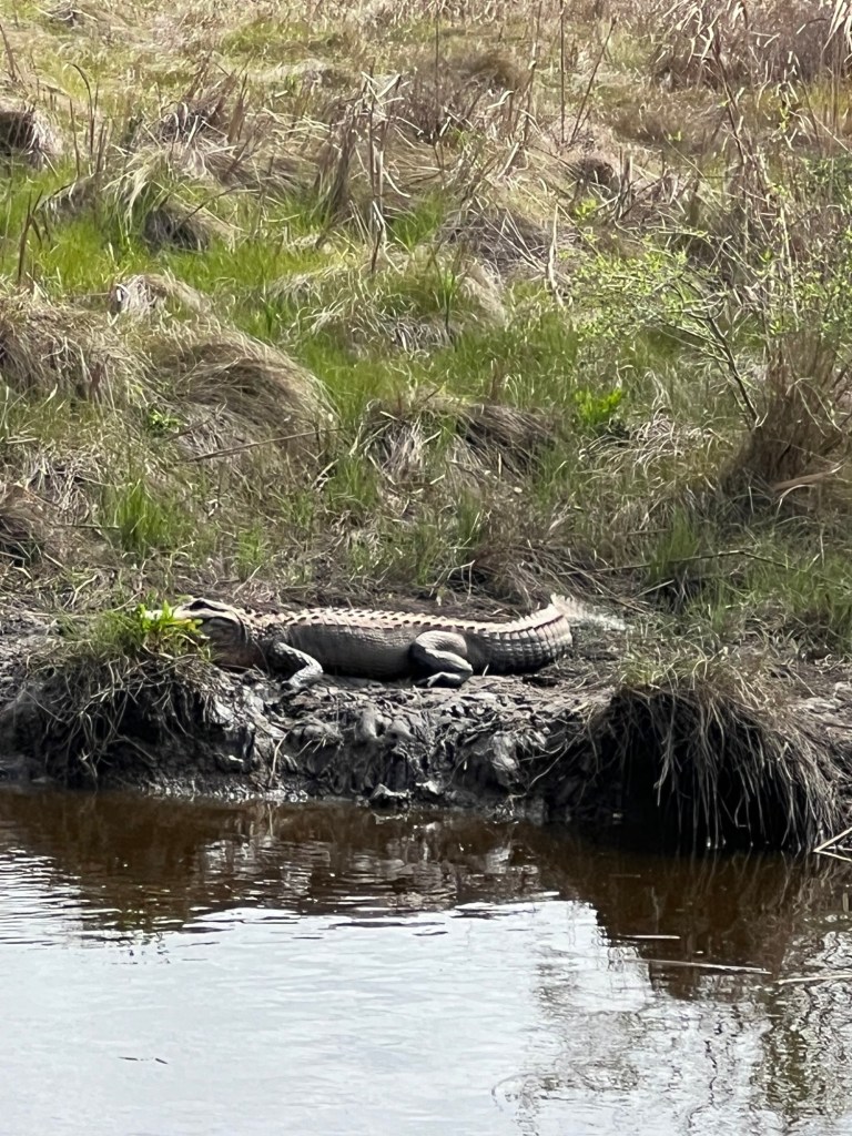
LJ and I recently embarked on a three-day marathon trip to my beloved East Texas – Big Thicket National Preserve. First on the agenda was the forty-two (42!) American alligators sunning themselves in the shallows of Shoulders Pond. You drive around this circle of a canal and note what you see.
Gators!
Second most exciting was the huge number of White Ibis spending the winter there. It could have easily been 50-60 or more. There were lots of coots, great egrets, great blues, little blues, snowy egrets, reddish egrets, gulls, and red-winged blackbirds.
After the drive, which took over two hours, we walked one of the trails. Even so far south not much was blooming. There were quite a few plums and maybe some pear trees, the invasive kind! Perhaps a few weeks later everything will be in bloom and there will be more birds. Put it on your bucket list!
An hour drive later we arrived at our luxury hotel in Kountze, my old home town, a real bargain at $66 a night! They had the cleanest towels I’ve ever seen! Not a joke. Really nice folks run the place, and it has a free breakfast and good maid service.
After a good night’s rest and supper at the local Dairy Queen, we drove north to the Geraldine Watson Preserve. My heart lives there. In my next life I will come back a Geraldine wannabe! They had done a recent burn trying to get rid of the invasive sphagnum moss and whatever is encroaching on the fantastic boardwalk. Everything here is maintained by the association of dedicated volunteers.
There were remnants of pitcher plants, and I got a really good picture of the remains of creatures left after the plant had dined on them. Cool!
Pitcher plants
There was lots of other interesting stuff – more to come – such as orchids, mushrooms, wildflowers, and birds. Do NOT fail to spend a morning there if you are in the area.
Geraldine wrote two books before she died. One is somewhat technical, about the geology of the area. One is about her adventures living in the area. It’s the best one in my humble opinion.
Next, we went on a drive on the Gore Store Road (try saying that fast three times!). Sadly, they are harvesting pines for lumber there – quite a few scary trucks loaded to the gills with long, tall, used-to-be-majestic trees. It was scary to drive behind them. A man who lives in the area tried to make a citizens’ arrest on us for trespassing on a vacant lot. Luckily, LJ talked him out of it. But we had to sacrifice a half hour charming him and convincing him we only wanted pictures. In the end, he even let us take a few shots on his property. There was very little worth reporting on the Gore Store Road – we never did find the store.
Lunch was at the barbeque place in Warren. It’s the best place to eat in the area and run by a very nice family. Friendly folks.
Off to the Sundew Trail. If you didn’t know, sundews are another carnivorous plant in the thicket. Again, not much was blooming. There is a great boardwalk and they have installed ten information stations that talk to you about what you are seeing. The best sighting was a brown green anole. You hardly ever see them colored.
Supper was an orange – too tired to eat.
Next day was Village Creek Park in Lumberton. There are very pretty cabins to rent. Homeward bound!
I went to sleep at 6:00 pm, was awake a few hours in the night, then slept until 7:00 am! I still think she’s after me. What do you think?
I had a wonderful opportunity to introduce young people (and some adults) to observing nature and learning from it. On March 9, I was invited to help a Cameron Cub Scout pack learn how to behave in parks and what to look for when you’re out in nature. We went to Chalk Ridge Falls Park, which is in Belton, on the Lampassas River, next to the Stillhouse Hollow Lake dam.
River View
The park is a great place to take young people, because the trails are wide, there are safe stairs, and there are many different ecosystems represented (riparian, woodlands, and prairie). One caution would be that children have to be supervised, because the river has carved a pretty steep canyon that is NOT fenced off. Also note that while there are stairs down to the river, they are steep and would be difficult for anyone with physical challenges to handle.
There were twelve children in attendance, including a couple of siblings of Cub Scouts. There were plenty of helpful adults, as well, so I could concentrate on finding items of interest to show them. We talked about littering and damaging park property, since this public park has a litter issue. The Scouts hope to come back to do public service by picking up trash – it was their idea!
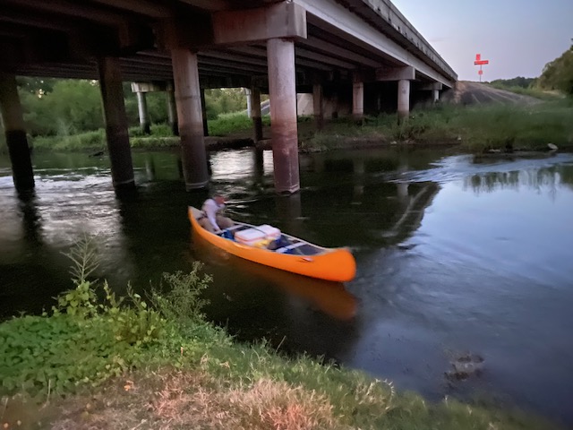
Checking out the bridge
We also talked about trail etiquette, such as not taking things from parks and staying on the path, which about 50% of the children were able to do. One thing I need to remember in doing this kind of thing is that nowadays many children will have attention-deficit disorders or may be on the autism spectrum, so it’s a good idea to present things that they all can benefit from. I did much better than I did last time I tried this, which led to a good time for all.
Since this is a city park, they probably expect kids to climb the trees.
Once the Den Mother and I showed the Scouts a few interesting flowers, bird nests, and pollen on tree catkins, the questions began. Some of the youngsters asked great questions about what they were observing or hearing (we heard a loud canyon wren, so I could explain that the park is the perfect habitat for them). I was asked about leaves, the berries on the cedar trees, how the seeds get in raccoon poop, and so much more. I was positively impressed at how much they got into the nature thing once they got started.
Exploringthe woodland and future wildflowers
Parents and grandparents also were paying attention and asking questions, and the Den Mother and I were surprised at how far we ended up going down the trail. They didn’t complain about being tired until we’d been out more than an hour. Speaking of going down the trail, the grandmother who came along was using a cane to help walk the trails. She initially said she’d just sit and wait when we went down some stairs to go over a bridge, but she got so interested in what her grandchildren were seeing that she made her way down and went the rest of the way with us. When we were finished, she said she was now ready to do squats. We got a good laugh out of that. But, that’s what being out in nature can do for you!
These stairs were in pretty good shape, though, and the grandparent made it.
Here’s what made the nature walk worth it to this Master Naturalist. One of the Cub Scouts had asked me many questions and was fascinated by flowering trees and berries. As we walked off from looking at some new thing, he turned around and ran up to me, with his little face aglow and shining black eyes. He exclaimed, “I love nature now!” He also wanted a photo with me when we left.
Here I’m showing them an oak gall
One of the young girls was also having a lot of fun. We got to the place where we were going to turn around, and some of the families had snacks. Her family had left theirs in the car, so they were going to go on back. She looked stricken and said to her mom, “But I want to stay here and continue this adventure!” I have to say I agreed with her. There was lots more to see, since there are many trails in the park.
Nice trails and plenty of resting spots
More than one parent mentioned wanting to come back and go further, without children. I think a field trip to do a BioBlitz here would be very worthwhile. I heard four types of wrens (before the children arrived) as well as other interesting birds, so it would be a good birding spot, too. Here are some of the things we saw.
I sure hope I can find more opportunities to lead nature walks. I think interpretation is my favorite part about being a Master Naturalist. I was so happy to see how much learning took place!
The original plan for February 16, 2024 was to conduct a long downriver trip on the Brazos to examine spots suitable for an overnight canoe trip in spring. However, lots of rain upstream inundated the very sand and gravel bars that serve as the best camping spots. An alternate plan was in order, so the team of intrepid explorers chose a feeder stream known to be shallow, gravelly, and home to mollusks. Call the stream Clam Creek, Mollusca Millrace, or Bivalve Bayou. Mussel Run turned out to be a special place on a special day.
The warm February air on a Friday morning we knew would soon turn cold, with a blue norther due to arrive the next day. Victoria and Rosie were eager to put some paddling time in as a tonic for spring fever, so we did a reconnaissance canoe trip down this creek that is usually too shallow to allow boat travel of any kind. Dragging two kayaks and a canoe down into the creek-bed was easy as the rainy winter had grown a deep carpet of winter grass along Mussel Run Creek in Falls County.
The three of us claimed “First Descent” along this small tributary of the Brazos River, since it was an unknown path to any and all in our group of “river runners.” In the grand scheme of things, others have surely traversed and crossed this old watercourse. Having a name on the map so appropriate to what we would find along this creek is a sure indicator that other people have visited here often. It has likely been known to many people, and probably over thousands of years.
Paddling the first 200 yards of this 7-mile run we found sand bars littered with the shells of bivalve mollusks. Many were freshly opened and probably eaten the night before. Racoon tracks were everywhere in the freshly washed sand. River Otter tracks were less abundant but also found along with beaver slides and feral hog sign. Mussel shells numbered in the many hundreds on the sandbars. Rosie wondered out loud if any of the species we were seeing were edible. “Sure they are! Particularly if you’re a racoon”. Wise guy…….
We found Giant Floater clams (Pyganodon grandis), Yellow Sandshell (Lampsillis teres), Threeridge (Amblema picata), and Mapleleaf (Quadrula quadrula). These mollusks were new to me, but Justin Grimm at Brazos River Authority quickly identified them from my amateur photos.
Justin is environmental programs coordinator at Brazos River Authority in Waco. Part of his duties are to survey and document the health of a wide assortment of aquatic plants and animals in one of the largest watersheds in Texas. This creek originates in upland areas east and north of Marlin, Texas. Streams which contribute flow in this watershed are Wild Horse Slough, Big Creek, Cedar Creek, and Brushy Creek among others. It is not until this stream reaches that flat red soil of the Brazos River flood plain that it obtains the name Mussel Run on the USGS topo maps.
We noted that the farm fields above us were located on fine red “Brazos bottom” alluvial silt that appeared to be 20-25 feet thick when looking up from the watercourse. Below it at water level there was a stark change in the geology, with a layer of bright white limestone conglomerated-gravel, with the aggregates being about the size and smoothness of ping-pong balls. This gravelly rock layer contributed most of the material that made up the hard bottom of the creek-bed we could feel with our paddles. I wondered if this high-calcium gravel accounted for the habitat that provided such a top-quality home for all these bivalve mollusks.
One thing for is for sure, and it is that this creek has been a major access barrier for river bottom farmers for most of the last two centuries. The creek channel is uniformly steep and has actively eroding sections of alluvial soil at almost every turn. Crossing it with mules and plows in the 19th century or with tractors in the 20th and 21st century has had to require extraordinary effort. The bridge we launched at is a brand-new concrete “highway-quality” structure at the end of a Falls County road. As we traveled down-stream we paddled over a concrete low water crossing probably 3-4 decades old clearly built by the landowners and not Falls County engineers.
We also passed under a high bridge structure that had steel I-beam upright pilings and a rickety wooden deck. This structure was a proper place to eat lunch but had signs on both ends stating WEAK BRIDGE CROSS AT OWN RISK. River bottom farm families have likely been using this structure since the 1920s, but heavy modern agricultural equipment crossing this structure is out of the question these days. A large disc plow was permanently embedded in the bottom of the creek where it apparently slid down an embankment during a severe erosion-causing flood event. It was a stark warning about the power of rainwater visible from the lunch-time observation spot.
Because this creek had flooded only 4 days prior to our trip we were able to float over almost every rocky riffle and fallen tree. Once we reached the confluence with the Brazos River, we got the opportunity to deal with the remains of that flood, to the tune of 6130 cubic feet per second (cfs) water flow. Riding on top of this dense flowing mass one can quickly cover miles with only moderate exertion with the paddle. The power of flowing water to excavate and move soil, push trees, and shove large objects is widely renowned. The reason is that water itself is so very heavy (62.4 pounds per cubic foot). The water flowing past us as we entered the river amounted to a 382,573-lb. object shoving us down-slope every second. Being whisked along was a joy after the hours of hard paddling in the slow water of the creek. What is most dangerous when the river is high are obstacles. If you get lodged against a tree or other immovable object in the stream, the force of the flow will quickly bend you and your boat into a very abnormal shape, and then hold you there like an angry 382,000-pound sumo wrestler. It is not an exaggeration to say “Death can come quickly.” Fortunately, we skimmed along the surface in mid-channel and arrived to have our pick-up crew (Adam and Angie) throw us ropes and pull the boats up the muddy shoreline. Now we know what is up along Mussel Run Creek and have the luxury of staying next to the wood stove on a Saturday morning.
Our Chapter President, Carolyn Henderson, was asked to put together ten photos of activities our group has engaged in over the past year, so they can be shared at next week’s Texas Master Naturalist Annual Meeting in McAllen, Texas (we will get to see the eclipse there!). We want to share this recap with all our blog readers and Facebook friends, too.
We look forward to more fun the rest of the year and in the future. Join us if you want to! You don’t have to be a member to attend our meetings and activities.
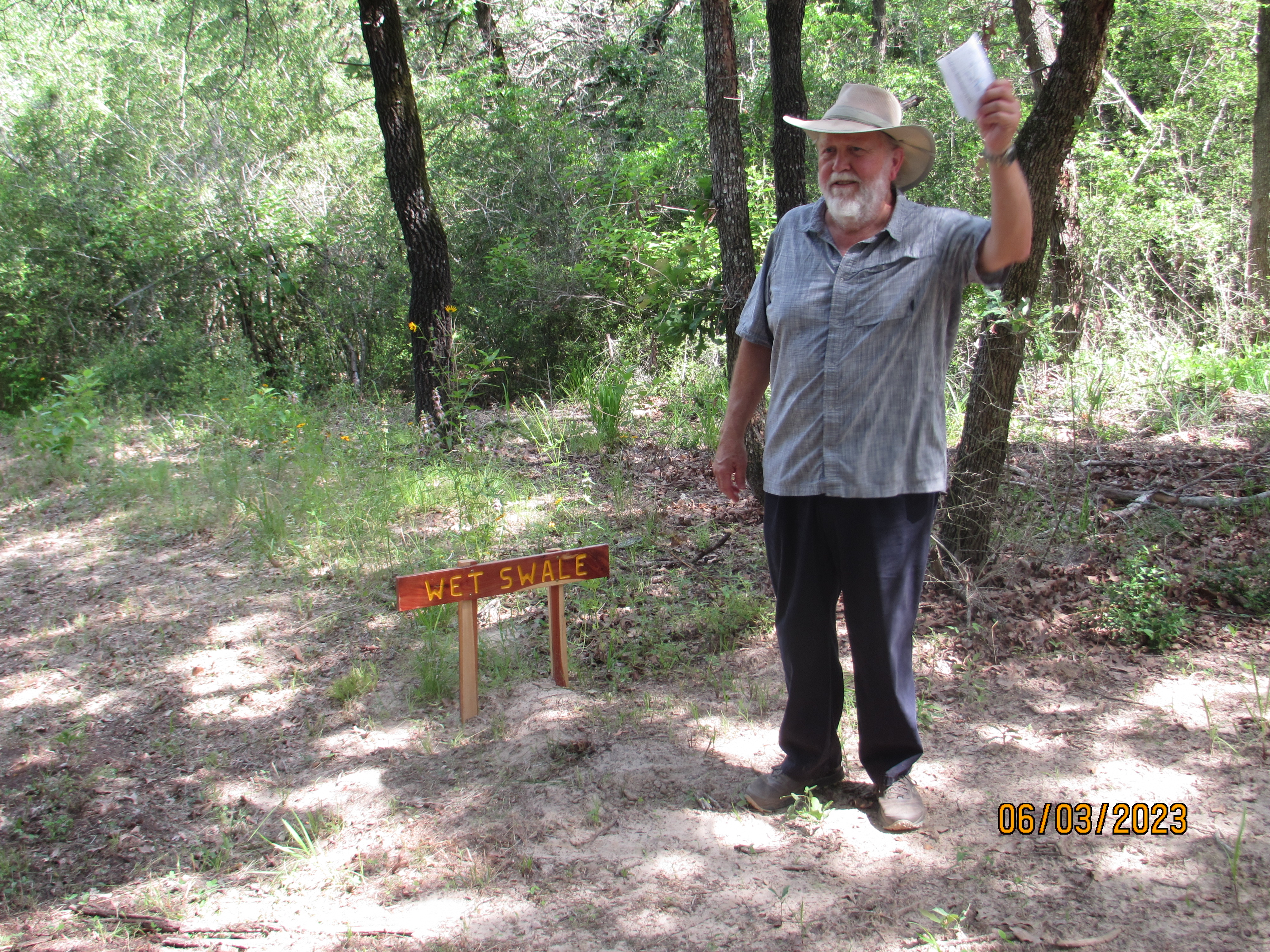
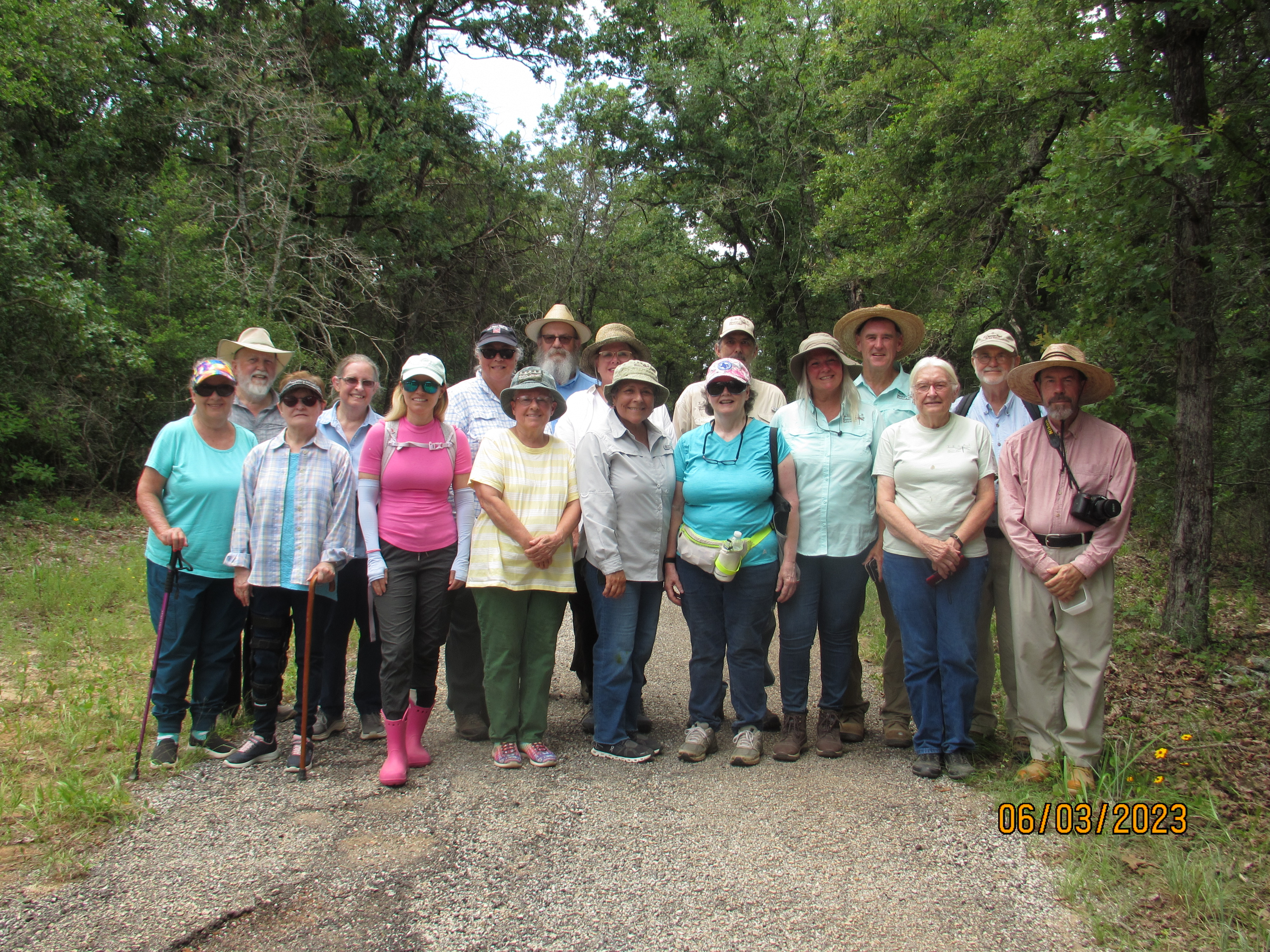
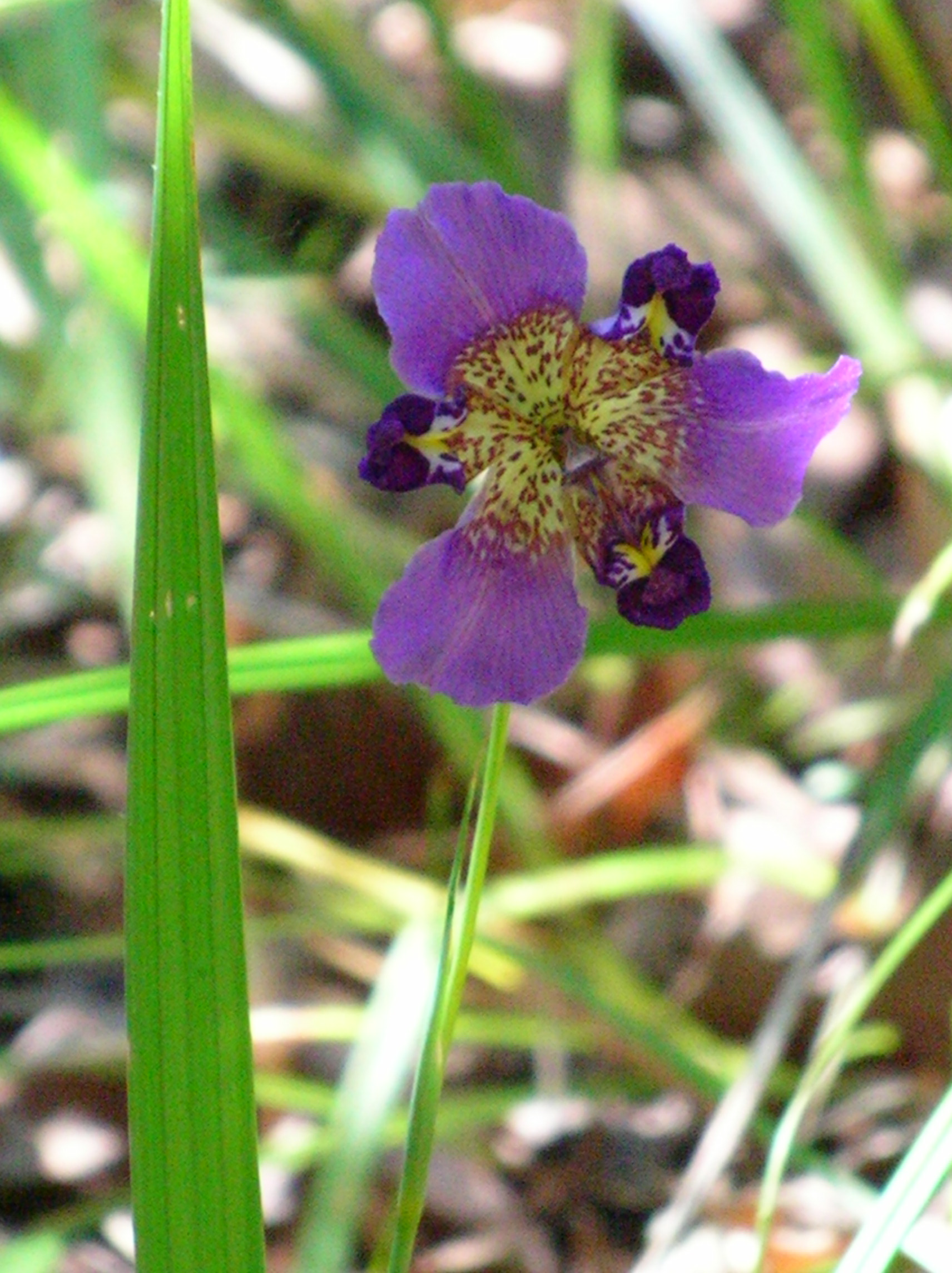
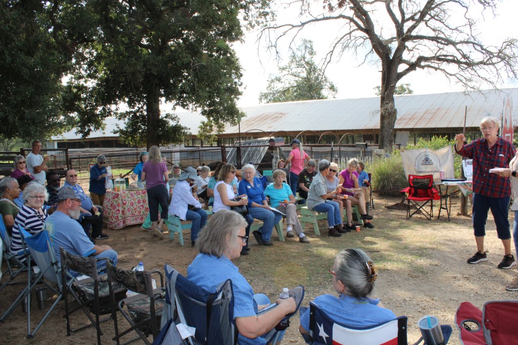
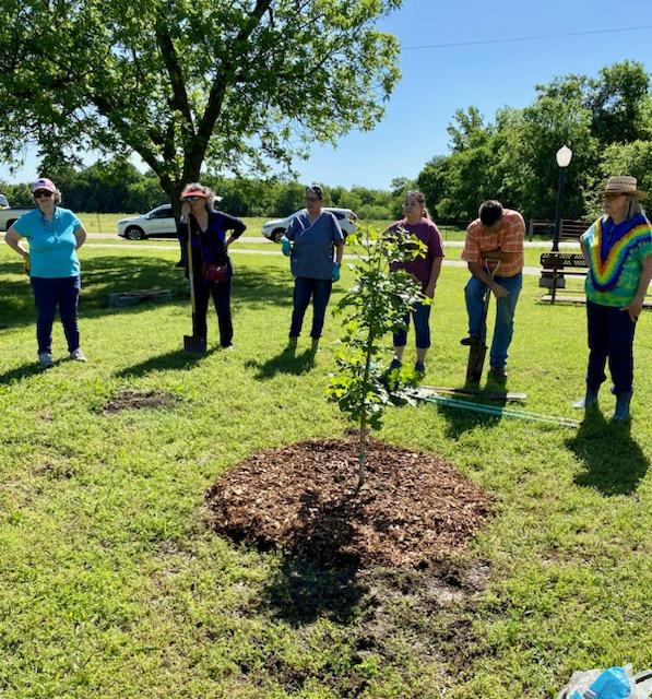
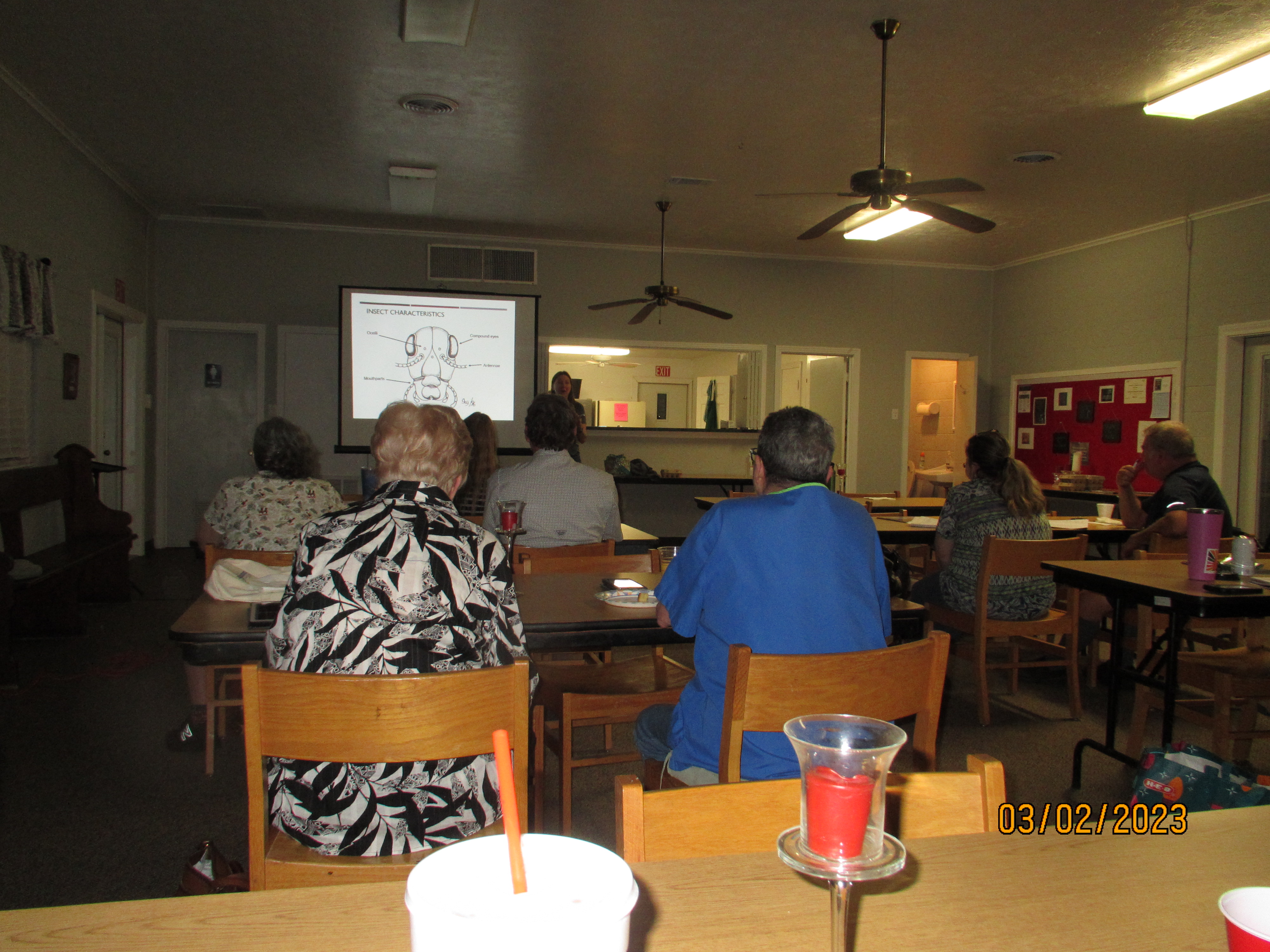
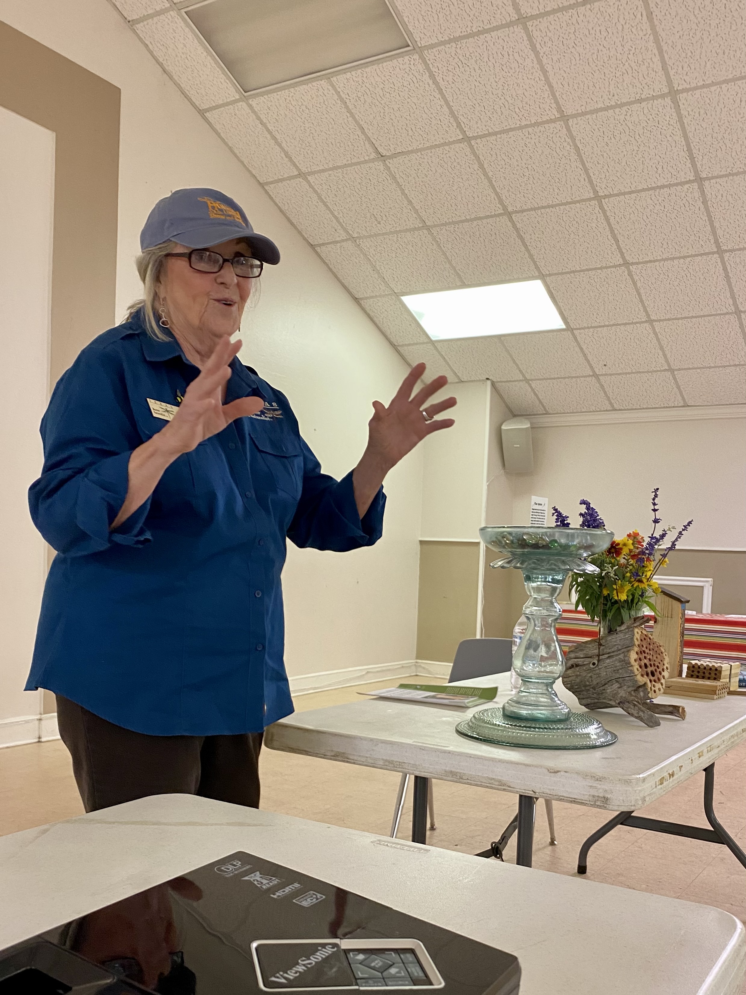
Master Naturalist Mike Conner, developer of the trail, explains “swales”Chapter members gathered after climbing the Rancheria Grande trail in Milam CountyUncommon flower found on the Rancheria Grande trail – “Propeller Flower” or Alophia drumondiiECR chapter presentation to the Little River chapter Master Gardeners on using native plants at the wildscapeGirdled Glossy Privets being removedPlanting a bur oak at a local park in CameronVisiting purple martin houses near BuckholtzNew trainees attend class on insects given by Wizzie Brown, AgriLife Agent from AustinTPWD Intern at Mother Neff State Park takes the chapter on a guided tourJackie Thornton teaches a bee class in Rockdale about setting up watering sites for beesMaster Naturalists talk with community members about feeding bees with native plants
Labor Day weekend this year cried out for a river trip, and the only “river” that was running hard on September 3 was a portion of the stream that the Spanish explorers dubbed the Rio San Francisco. Stephen F. Austin drew a map of the expanding land grants between the Brazos and Colorado Rivers in 1829 and labeled this same stream Yegua. It stands to reason that those people occupying the land at that time had identified this watercourse as a place populated with horses. Yegua in Spanish are female horses. A valley to the west of the Brazos River with a significant abundance of horses deserves such a distinctive name. St. Francis of Assisi was already known as “the patron saint of animals” when the Spanish priests were spreading their culture north into Texas circa 1690. His name would be attached to many other places and a few streams. The Texas stream that is named after the horse populations attracted to its bottomland habitat is a special kind of place. It was my time to explore it.
Adam and I put boats into the water of Yegua Creek below the Hwy 36 bridge in Somerville. It was before dawn, and I was hoping to paddle the first portion of a 13-mile run in moonlight. As luck would have it, we were running a bit too late, and the moon was slightly obscured by thin clouds anyway. Angie was our driver and her photographs taken as we shoved off show an orange dawn sky looking downstream. Turns out it was a darn good thing we could see well because the first three miles of this trip seemed like a combination of paddling through a Venezuelan jungle and the log-ride at Six Flags. We needed full visual acuity. Short-statured elm trees reached far out from each shore, and you had to weave around them. Open shorelines were densely populated with sedges, rattle bean, millet, and smartweed. Somerville Dam was just a mile upstream and was releasing 366 cubic feet per second to supply users down near the Texas coast. In this 40-60-foot-wide channel the water was pushing hard toward the Brazos and shoving our boats with it.
The narrow channel was alive with insect life on the water surface and in the air above it. There were clouds of small insects buzzing about us but not biting or landing upon us. I suspect they were midges (I inadvertently swallowed several but could not identify species from the taste), and they were being attacked and fed upon by an astounding number of dragonflies. In the dawn’s early light thousands of dragonflies of many sizes and colors were passing through the dense haze of Chironomids and eating them in mid-air. Looking upward was like watching tuna feeding on schools of sardines. Dragonflies were to be over and around us all day.
Lots of supplies in Alan’s canoe
One of my worries about running a narrow creek was about how many large trees would be lying completely across the channel. Very rapidly Adam scraped over the top half of a semi-submerged log in his kayak but my cargo canoe loaded with water and food could not pass. We pulled to shore, carried the cargo around and then portaged the canoe 60 feet to reload and relaunch. This turned out to be the only portage of the day and I pointed out to Adam that many famous “canoe trails” in Maine and Minnesota have ¼ mile portages between upland ponds that have no water flowing between them. This kind of portage was a cinch unless there turned out to be one tree every half-mile.
Very rapidly we were off, and then came the rapids. The first was a washed-out concrete vehicle crossing that had collapsed in the middle. Both boats sailed through the gap and the Yegua carried us soon to a second loud crashing of water half a mile downstream. This spot was a concentration of large rock rip-rap strewn across the channel and below a powerline that supplies Somerville and Caldwell. Construction crews likely used this material when stringing wires 50 years ago. The heavy water flow got us over the rocks and into the big eddy four feet below. No problem! However, this day was far from over.
The next rapids could be heard but were hidden around a hard right turn. It ended up being a steep drop of 5-6 feet. This spot is a natural rock formation. The 366 cfs filled my boat when I went over the drop and was pushed sideways into a rock wall. This, dear hearts, is why we tie all our gear securely into the canoe.
The entire boat was full of creek water in under three seconds and was being pushed rudely downstream. The water jugs, canteens, Pelican box holding my I-phone, ice chest (strapped tightly closed), first aid kit were all attached. Adam, who had shot through the rapids ahead one minute ahead of me in the kayak, had spun around to watch as I inelegantly exited my boat and was floating along beside it in my ugly brown PFD (personal floatation device). Don’t ever let anybody tell you it is too hot to wear a PFD (even an ugly brown one), especially on a reach of river that you have never traveled before. We were shoved downstream 300 yards along straightaways and around corners before an adequate sandbar was located to pull up the water-filled canoe.
The PFD was absolutely essential to keeping me from snagging a pant-leg or belt on a submerged tree-limb while being dragged along. The water temperature felt good in late summer, but in winter getting “tumped” over would have been a problem that required quickly building a fire to heat up a shivering paddler (me). Yet another reason you never paddle alone. It is hard to start a fire when you are shaking like a coon-dog trying to pass a peach pit.
Adam in kayak ready for adventure on Yegua Creek near Lake Somerville
The fourth rapid was halfway through the trip and had a large rock in the middle of the river. A lunchtime spot! The rest of the trip was delightful. Magnificent pecan and willow trees over-hung the river. We paddled in the shade almost the entire day. Without question the largest black willow trees I have ever seen stand like mythical giants along the Yegua. I wondered what it takes to be the state record Salix nigra? Two of these we saw had to be contenders.
Beautiful live oaks grew on both the Washington County bank and the Burleson County shore. Big antlered deer and feral hogs were sleeping and feeding in the lush green growing on the shoreline sandbanks. There were two old, abandoned county road bridges. Cattle swam and waded back and forth across the county line (who needs bridges?). We noted two minimalist fish camps but not a single drop line was seen. This apparently is rod and reel territory.
Adam and Alan on Yegua Creek near Lake Somerville just past HWY 36 bridge
Having unceremoniously plopped over my trusty OUACHITA, I was glad I did not bring my binoculars. Many small birds flying across in front of me consequently went unidentified. I did note eastern phoebes, pileated woodpeckers, a lone anhinga, wood ducks, a Louisiana heron, green herons galore, and great blue herons. At least my vision is still good enough to see the big ones!
The surprised behavior of a lone coyote suggested he had never seen a boat before. Deer antlers seem big this year based upon the whitetail bucks we flushed. That cool rainy spring must have provided protein at the right time for a lot of grazing animals. Francis of Assisi would be pleased.
The nice thing about this canoe trail is that it has easy access to put in on Hwy 36 and easy access to take out at Hwy 50 near Clay, Texas. Driving home through Independence and eating Mexican food at Las Fuentes in Somerville after a 6-hour paddle was a sweet finish to a Labor Day Sunday trip. Always bring dry clothes or lunch must be eaten in the outdoor heat.
Nowadays the Yegua is considered a “creek.” After experiencing the intensity of the flow and taking a thorough dunking at a natural waterfall I can see why those well-educated Padres and Spanish Expedition commanders wrote down in their diaries that the San Francisco was a river.
Yegua Creek, which is actually a river. Photo by Alexey Sergeev, 2020. Public domain. (as you read on you’ll see why Alan shared no personal photos)