by Alan E. Rudd
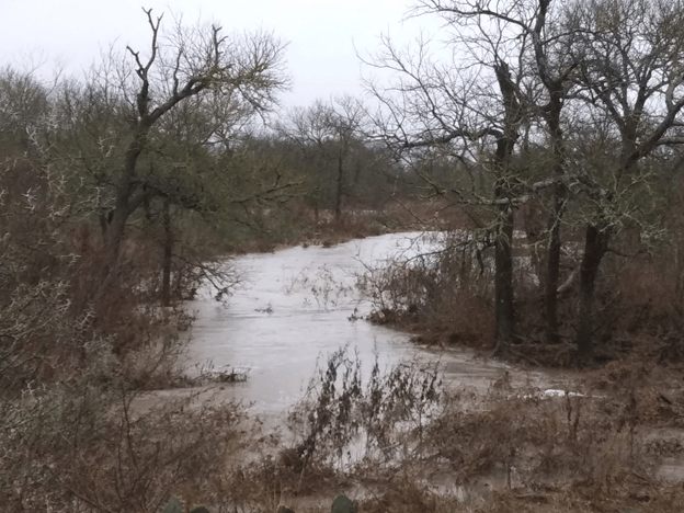
The original plan for February 16, 2024 was to conduct a long downriver trip on the Brazos to examine spots suitable for an overnight canoe trip in spring. However, lots of rain upstream inundated the very sand and gravel bars that serve as the best camping spots. An alternate plan was in order, so the team of intrepid explorers chose a feeder stream known to be shallow, gravelly, and home to mollusks. Call the stream Clam Creek, Mollusca Millrace, or Bivalve Bayou. Mussel Run turned out to be a special place on a special day.
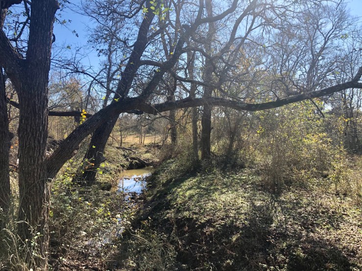
The warm February air on a Friday morning we knew would soon turn cold, with a blue norther due to arrive the next day. Victoria and Rosie were eager to put some paddling time in as a tonic for spring fever, so we did a reconnaissance canoe trip down this creek that is usually too shallow to allow boat travel of any kind. Dragging two kayaks and a canoe down into the creek-bed was easy as the rainy winter had grown a deep carpet of winter grass along Mussel Run Creek in Falls County.
The three of us claimed “First Descent” along this small tributary of the Brazos River, since it was an unknown path to any and all in our group of “river runners.” In the grand scheme of things, others have surely traversed and crossed this old watercourse. Having a name on the map so appropriate to what we would find along this creek is a sure indicator that other people have visited here often. It has likely been known to many people, and probably over thousands of years.
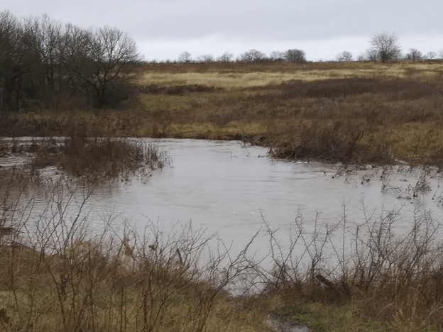
Paddling the first 200 yards of this 7-mile run we found sand bars littered with the shells of bivalve mollusks. Many were freshly opened and probably eaten the night before. Racoon tracks were everywhere in the freshly washed sand. River Otter tracks were less abundant but also found along with beaver slides and feral hog sign. Mussel shells numbered in the many hundreds on the sandbars. Rosie wondered out loud if any of the species we were seeing were edible. “Sure they are! Particularly if you’re a racoon”. Wise guy…….
We found Giant Floater clams (Pyganodon grandis), Yellow Sandshell (Lampsillis teres), Threeridge (Amblema picata), and Mapleleaf (Quadrula quadrula). These mollusks were new to me, but Justin Grimm at Brazos River Authority quickly identified them from my amateur photos.


Justin is environmental programs coordinator at Brazos River Authority in Waco. Part of his duties are to survey and document the health of a wide assortment of aquatic plants and animals in one of the largest watersheds in Texas. This creek originates in upland areas east and north of Marlin, Texas. Streams which contribute flow in this watershed are Wild Horse Slough, Big Creek, Cedar Creek, and Brushy Creek among others. It is not until this stream reaches that flat red soil of the Brazos River flood plain that it obtains the name Mussel Run on the USGS topo maps.
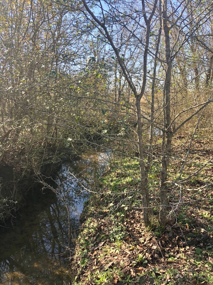
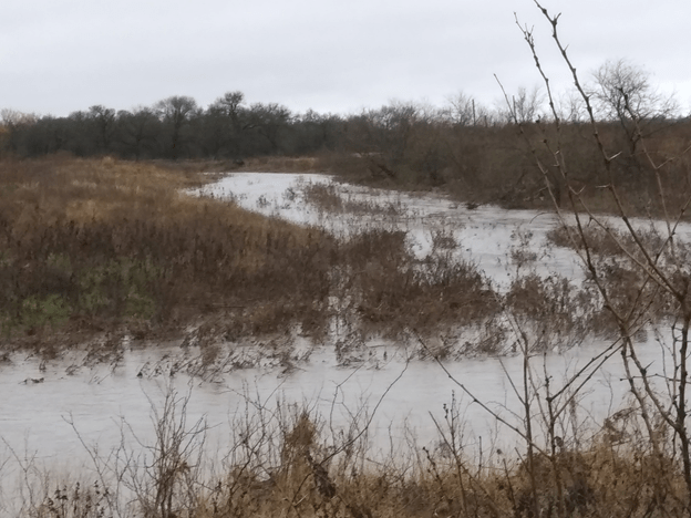
We noted that the farm fields above us were located on fine red “Brazos bottom” alluvial silt that appeared to be 20-25 feet thick when looking up from the watercourse. Below it at water level there was a stark change in the geology, with a layer of bright white limestone conglomerated-gravel, with the aggregates being about the size and smoothness of ping-pong balls. This gravelly rock layer contributed most of the material that made up the hard bottom of the creek-bed we could feel with our paddles. I wondered if this high-calcium gravel accounted for the habitat that provided such a top-quality home for all these bivalve mollusks.
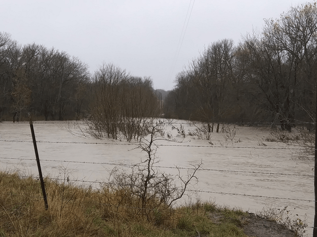
One thing for is for sure, and it is that this creek has been a major access barrier for river bottom farmers for most of the last two centuries. The creek channel is uniformly steep and has actively eroding sections of alluvial soil at almost every turn. Crossing it with mules and plows in the 19th century or with tractors in the 20th and 21st century has had to require extraordinary effort. The bridge we launched at is a brand-new concrete “highway-quality” structure at the end of a Falls County road. As we traveled down-stream we paddled over a concrete low water crossing probably 3-4 decades old clearly built by the landowners and not Falls County engineers.
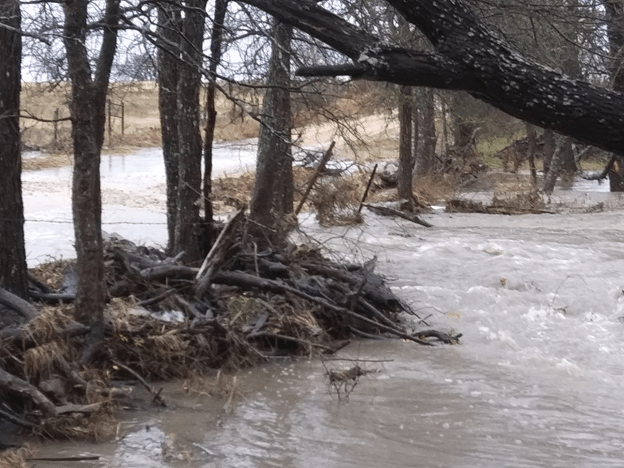
We also passed under a high bridge structure that had steel I-beam upright pilings and a rickety wooden deck. This structure was a proper place to eat lunch but had signs on both ends stating WEAK BRIDGE CROSS AT OWN RISK. River bottom farm families have likely been using this structure since the 1920s, but heavy modern agricultural equipment crossing this structure is out of the question these days. A large disc plow was permanently embedded in the bottom of the creek where it apparently slid down an embankment during a severe erosion-causing flood event. It was a stark warning about the power of rainwater visible from the lunch-time observation spot.

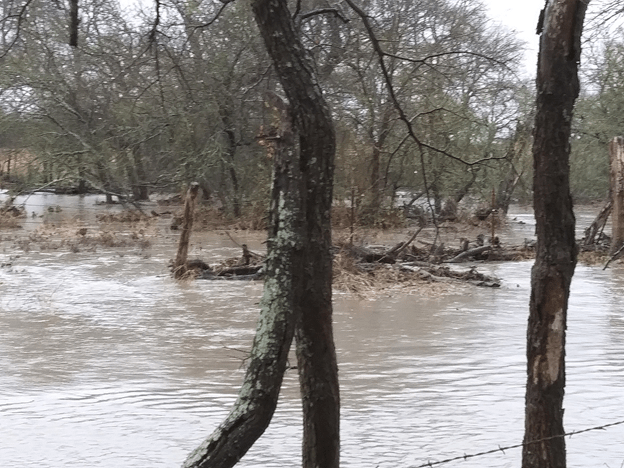
Because this creek had flooded only 4 days prior to our trip we were able to float over almost every rocky riffle and fallen tree. Once we reached the confluence with the Brazos River, we got the opportunity to deal with the remains of that flood, to the tune of 6130 cubic feet per second (cfs) water flow. Riding on top of this dense flowing mass one can quickly cover miles with only moderate exertion with the paddle. The power of flowing water to excavate and move soil, push trees, and shove large objects is widely renowned. The reason is that water itself is so very heavy (62.4 pounds per cubic foot). The water flowing past us as we entered the river amounted to a 382,573-lb. object shoving us down-slope every second. Being whisked along was a joy after the hours of hard paddling in the slow water of the creek. What is most dangerous when the river is high are obstacles. If you get lodged against a tree or other immovable object in the stream, the force of the flow will quickly bend you and your boat into a very abnormal shape, and then hold you there like an angry 382,000-pound sumo wrestler. It is not an exaggeration to say “Death can come quickly.” Fortunately, we skimmed along the surface in mid-channel and arrived to have our pick-up crew (Adam and Angie) throw us ropes and pull the boats up the muddy shoreline. Now we know what is up along Mussel Run Creek and have the luxury of staying next to the wood stove on a Saturday morning.